What happened and where
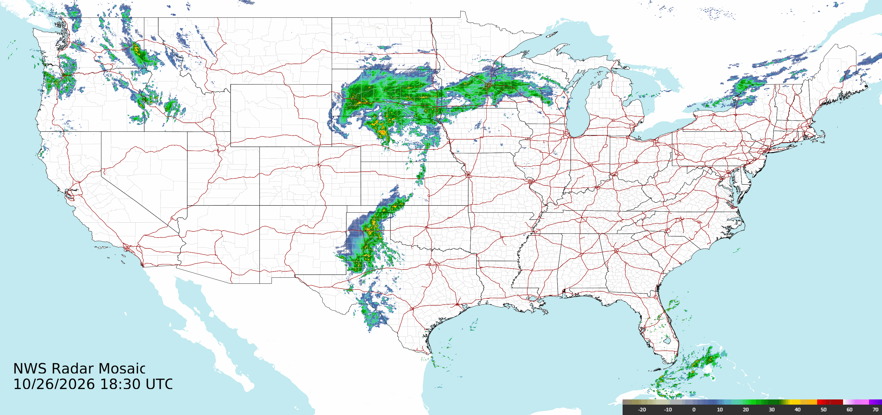
Multiple regional outlets report that a late storm system brought heavy rain across the Four Corners area and triggered new rounds of flooding. Local reporting specifically cites renewed flooding in parts of Utah and the broader Four Corners region, and at least one tornado was reported during the event, according to coverage reviewed by Freedom News Staff.
The Phoenix-based reporting network KJZZ said the San Juan River was approaching a historic crest as floodwaters rose, while other local outlets described flash flooding and localized inundation after days of wet weather. The Weather Channel and other regional news organizations say some evacuations remained in place as crews monitored river levels and community safety.
Rivers, evacuations and immediate impacts
Reports emphasize riverine flooding as a principal concern. KJZZ described the San Juan River nearing a historic crest, a development that typically raises the risk of wider downstream inundation and prompted local authorities to monitor and respond where needed.
The Weather Channel reported that evacuations were still in effect in parts of the flood zone as of its latest story, and local outlets urged residents in low-lying areas to heed official guidance. The coverage reviewed does not include consolidated statewide lists of closures, displacement counts, or formal damage tallies; those details were not provided in the supplied reporting.
Tornado reports and official confirmation
WHEC and other outlets say at least one tornado was associated with the storm system. News coverage used language of a reported tornado rather than a final meteorological confirmation.
Freedom News Staff did not find a National Weather Service (NWS) confirmation or an NWS tornado warning text within the set of summaries supplied for this article. That does not mean the NWS has not since issued confirmations or warnings; it means the specific source material we were given did not include those primary advisories. For precise confirmation and any damage surveys, the NWS and local emergency management offices remain the authoritative sources.
Why the Four Corners saw renewed severe weather and the short‑term outlook
The coverage attributes the immediate cause to a storm system that produced heavy rainfall across a region already soaked by previous storms. Multiple outlets described the rain as heavy enough to produce flash flooding and to push river stages higher, particularly on the San Juan River.
Local reporting and national weather outlets noted that the system produced additional rounds of precipitation and severe‑weather threats over areas that had already seen several wet days, increasing the risk that soils and tributaries could not absorb more water. The Weather Channel and WCBD both flagged the possibility of continued rain and additional flooding in the short term.
Because the supplied reporting did not include NWS forecast discussions, watches, or specific radar tracks, Freedom News Staff cannot provide the detailed storm track, hour‑by‑hour timing, or model guidance here. Readers seeking that level of technical detail should consult the National Weather Service forecast discussion for the relevant local forecast office, local emergency management agencies, and real‑time radar imagery.
What remains uncertain and what to watch next
Key gaps remain in the source set reviewed for this article. The supplied summaries do not include an official NWS confirmation of tornadoes or an NWS list of active watches and warnings tied to these storms; they do not provide a comprehensive count of damaged structures, injuries, or fatalities; nor do they list a complete roster of evacuation orders or shelter locations.
Freedom News Staff recommends residents and travelers in the Four Corners area monitor local emergency management channels, their county or tribal alerts, and the National Weather Service for updated river forecasts, flood warnings, tornado confirmations, and sheltering orders. Those primary sources will also carry any emergency declarations, road closures, and the latest life‑safety instructions.
Practical takeaways for residents
If you live in low‑lying areas or along known river corridors such as the San Juan River, be aware that river levels can rise quickly during repeated heavy rain events. Follow local evacuation notices; do not attempt to drive through flooded roadways; and move to higher ground when officials advise it.
For those tracking this event from afar: multiple regional outlets report renewed flooding and at least one tornado tied to the recent storms, the San Juan River is reported to be near historic levels, and evacuation orders were reported in some areas. The situation remained fluid in the reporting reviewed here, and official agencies are the final authority on lifesaving orders and hazard confirmations.
Sources reviewed
- WHEC.com: More flooding in Four Corners region after storms bring heavy rain and at least one tornado
- Yahoo News Canada: Flooding in Utah after storms in Four Corners region bring heavy rain and at least one tornado
- WCBD News 2: More flooding possible in Four Corners region after days of heavy rain
- KJZZ: Heavy rain floods Four Corners as San Juan River nears historic crest
- kjzz.com: More flooding in Four Corners region after storms bring rain and at least one tornado
- KRMG: Artificial intelligence giant Anthropic files papers to sell shares to the public for the first time
- The Weather Channel: Still more rain, evacuations remain in place from Four Corners region flooding
- KMYU: Luka Doncic scores NBA season-high 52 points in the Lakers' victory over the Jazz
- cedarnews.net: More flooding in Four Corners region after storms bring heavy rain and at least one tornado - Sentinel Colorado