What the coverage agrees on
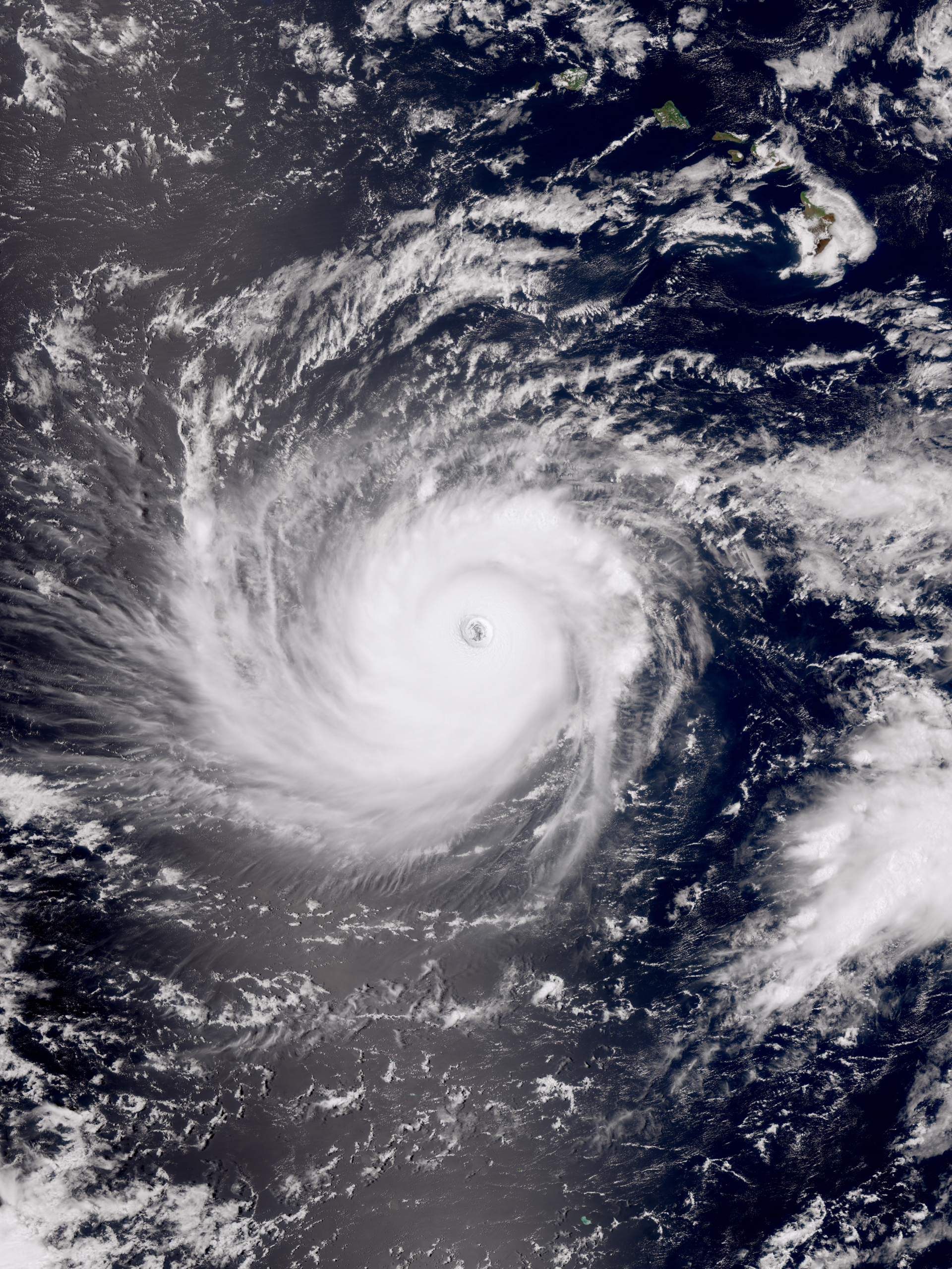
Multiple national and local outlets report that Hurricane Lowell is a major storm — routinely described as Category 4 in recent coverage — and that forecasts show a pronounced northward turn that could bring the system closer to the Hawaiian Islands. Outlets noting this trajectory include The Weather Channel, CNN, USA Today, KHON2, KSL and regional outlets such as Big Island Video News.
The coverage frames the main uncertainty as how close Lowell will come to specific islands and how much intensity it will retain if (or when) it changes course. Yale Climate Connections published an explainer focused on that question, while local and national weather reporting emphasized the potential for impacts that typically accompany a strong hurricane approaching island chains: heavy rain, high surf and coastal inundation, flash flooding and damaging winds.
What the forecasts imply — and what they do not yet confirm
Taken together, the reporting indicates a credible risk that Lowell could affect parts of Hawaii. The exact track, timing and intensity at closest approach remain uncertain in the public reporting reviewed by Freedom News Staff. Because the supplied coverage summaries do not include the text of the National Hurricane Center (NHC) advisories or specific numeric forecast products, this article does not reproduce precise NHC values such as current maximum sustained winds, gusts, central pressure, closest approach distances or officially issued county‑level watches and warnings.
That uncertainty matters for practical outcomes. A track that passes several dozen miles offshore will present a very different mix of surf, surge and wind than a track that brings the storm center directly over an island. Similarly, whether the storm weakens before approach or holds as a major hurricane will change the probable wind and rainfall footprints. Reporters and analysts in the supplied stories repeatedly emphasize that residents should not focus on any single model run and should instead watch official NHC products and local emergency management announcements for changes.
Local context and preparedness
Local reporting described Hawaii as bracing for another tropical threat after recent storms in the same month. KSL noted that this would be the third storm threat in a month for the state, a factor that can amplify vulnerabilities such as saturated soils, high surf already onshore, and strained local response resources.
Regional outlets and weather desks are urging residents and travelers to review emergency plans, secure loose outdoor items, refill critical prescriptions and prepare basic supplies such as water, nonperishable food, flashlights, batteries and a charged phone. Freedom News Staff recommends readers identify evacuation routes and know how to receive emergency alerts from county civil defense and the state of Hawaii.
What we could not corroborate from the supplied reporting
The set of source summaries made clear that Lowell is a major hurricane being watched for a northward turn toward Hawaii, but they did not include the underlying NHC/NOAA advisory text or specific county watch/warning bulletins. As a result, this article cannot and does not state authoritative numeric values (current sustained winds, gusts, central pressure), exact closest‑approach distances or which counties — if any — are under watches or warnings at the moment of publication.
Similarly, the summaries did not include documented lists of local closures, mandatory evacuations, airline or port notices, or federal preparedness actions such as pre‑positioned FEMA assets. Readers who need those operational details should consult the National Hurricane Center, the Hawaii Emergency Management Agency and county civil‑defense offices directly; those primary sources publish the official watches, warnings, rainfall guidance, storm‑surge products and any evacuation orders.
How to follow the hazard and where to look for updates
For the authoritative forecast, seek the National Hurricane Center's public advisories, forecast discussions and forecast/advisory graphics. Local county civil‑defense agencies and the Hawaii Emergency Management Agency are the official sources for county‑level watches, warnings, evacuation orders and shelter information. Local broadcasters in Hawaii — including both network affiliates and island‑specific outlets cited in the coverage — will also carry updates and practical guidance.
For visual assets and newsroom needs, primary sources of satellite and radar imagery are NOAA and the National Hurricane Center; local TV stations and regional weather services often republish those satellite loops alongside their radar mosaics. If you are tracking travel plans, check live airline and port notices directly with carriers and port authorities rather than relying on third‑party summaries.
What to watch next
Key developments that will change the public guidance are any NHC issuance of tropical‑storm or hurricane watches/warnings for specific Hawaiian counties, official county evacuation orders or shelter openings, and significant shifts in the forecast track or intensity in subsequent advisories. Media and emergency managers will update the public as those changes occur.
Freedom News Staff will monitor incoming advisories and local emergency channels and will update this story when primary NHC advisories, county watch/warning bulletins, or official evacuation or closure notices are available in the public record.
Sources reviewed
- The Weather Channel: Major Hurricane Lowell set to bring impacts to Hawaii
- KHON2: Category 4 Hurricane Lowell forecasted to curve north toward islands
- fredpickhardt.substack.com: Hurricane Lowell Update: Saturday Sept. 5th
- CNN: Hurricane Lowell remains powerful Category 4 as Hawaii braces for possible impacts
- Yale Climate Connections: How close to Hawaii will Hurricane Lowell get?
- KSL News: Hawaii braces for major Hurricane Lowell, its third storm threat in a month
- USA Today: Major Hurricane Lowell forecast to make sharp turn toward Hawaii
- FOX Weather: Bryan Norcross: Last day for Edouard's rain in Texas while we watch Lowell and Hawaii for early next week
- Big Island Video News: Hurricane Lowell, Hurricane Karina Update for Thursday, Sept. 3
- Yahoo News Canada: Major Hurricane Lowell poised for dramatic turn toward Hawaii, raising threat of direct impact