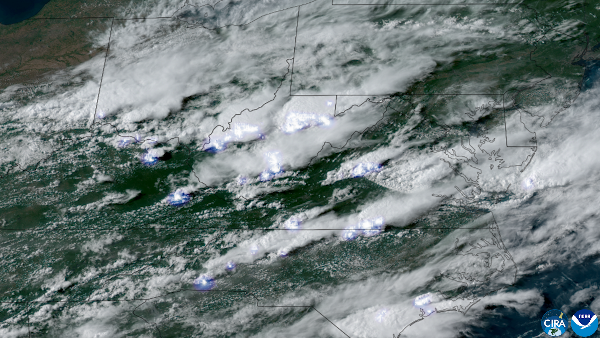
What happened: storms, tornadoes and flooding across the region
A potent storm system drenched parts of the Mid‑Atlantic and Northeast, and multiple news organizations report that tornadoes struck in the New York City area during the same episode. The New York Times described the appearances of tornadoes in the city as rare, while regional outlets reported both tornado activity and widespread flash flooding as the system moved through populated corridors.
Coverage compiled by Westfair Communications and by KVIA, a regional broadcaster, says the same storm cell cluster produced several tornadoes across portions of the Mid‑Atlantic and sparked widespread flash flooding in low‑lying and urban areas. KVIA’s reporting emphasized heavy rainfall and flash flooding accompanying the severe‑weather threat, while New York reporting focused on the unusual nature of tornadoes reported in the city itself.
At this stage the reporting in national and regional outlets aligns on the broad outlines: a severe‐weather system moved through the Mid‑Atlantic, bringing intense rain, localized flooding and reports of tornadic activity concentrated in and near the New York City metropolitan area. Formal storm surveys and National Weather Service confirmations are not included in the set of sources reviewed for this article and are likely to follow as local offices complete on‑the‑ground assessments.
What we know, what is still uncertain
Multiple independent news organizations reported tornadoes tied to the storm, which is notable because tornadoes in New York City are uncommon. The New York Times framed the tornado reports as rare for the city; regional reporting echoed that characterization and added accounts of heavy, flooding rainfall.
Important details remain unresolved in the public reporting reviewed here. Specifically, the authoritative post‑event determinations — including exact tornado tracks, ratings, start and end points, and whether the National Weather Service will issue confirmed tornado designations for the NYC incidents — were not part of the available source summaries. Similarly, precise counts of tornadoes, detailed damage tallies, confirmed injury reports, power‑outage numbers, and street‑level closure information were not supplied in the sourced material. Those items are normally produced in NWS storm surveys and by local emergency management and utility companies as daylight inspections proceed.
Because the initial reporting comes from news coverage rather than primary storm‑survey releases, readers should expect updates from the National Weather Service and from municipal emergency offices that will clarify the number of tornadoes, assign official ratings where applicable, and disclose the scope of damage and outages. The absence of those primary records does not contradict the immediate news accounts; it does mean that some technical specifics about the events remain provisional and subject to revision.
Why this matters and what to watch next
Tornadoes in dense urban areas carry a mix of unusual risks: concentrated population, vulnerable infrastructure, extensive glass and high‑rise exposures, and transportation systems that can be quickly disrupted. Flash flooding compounds those risks in built environments where stormwater systems can be overwhelmed, producing stranded vehicles and flooded transit corridors. Regional reporting flagged both hazards in this event, with flash flooding emphasized in Mid‑Atlantic coverage and the rarity of urban tornadoes highlighted in New York reporting.
In practice, the next authoritative steps to watch are the National Weather Service’s post‑event storm surveys and local agency damage assessments. Those will determine whether meteorologists confirm tornado touchdowns and will provide storm‑track maps, intensity ratings, and timelines. Local emergency management offices and utilities typically follow with consolidated statements about injuries, outages, road closures, and recovery timelines. Readers and residents should rely on those official channels for verified situational updates.
For residents in affected corridors the immediate practical guidance is straightforward and consistent with routine severe‑weather preparedness: when severe‑weather warnings are issued, move to an interior room away from windows if tornadoes are possible; avoid driving through flooded roadways; follow instructions from municipal emergency management and transit authorities; and expect service interruptions as crews assess and repair damage. These general safety steps are standard practice during combined flood and tornado threats and are the quickest way to reduce personal risk ahead of formal post‑storm analyses.
Context and the limits of current reporting
Major news outlets described the occurrences as rare for New York City and placed them within a broader Mid‑Atlantic severe‑weather episode that included heavy rain and flash flooding. The characterization of rarity comes from journalistic reporting rather than a specific climatological calculation provided in the source summaries; formal historical frequency data and long‑term trends were not part of the materials reviewed for this piece.
The question of whether any single event is causally linked to climate change requires specialist analysis of atmospheric data, baseline trends, and attribution studies. Those analyses are usually published by peer‑reviewed researchers or national agencies and were not included in the immediate coverage reviewed here. Readers should expect subsequent expert commentary if meteorological surveys and climatologists analyze the event for unusual atmospheric drivers or long‑term pattern shifts.
For now the verified, publishable facts are these: multiple credible regional and national outlets reported that a severe storm drenched the Mid‑Atlantic, producing widespread flash flooding and reports of tornadoes in and near New York City. The technical confirmations and detailed damage and casualty assessments remain to be supplied by the National Weather Service, local emergency management agencies and utilities.
What readers should watch
1) National Weather Service offices for official storm surveys and tornado confirmations. 2) Local emergency management and utility statements for damage, outages and public‑safety advisories. 3) Transit agencies and roadway authorities for closures and recovery timelines. Expect those primary records to appear in the hours and days after the event and to clarify counts, tracks and ratings mentioned in initial news reports.
Freedom News Staff will monitor those primary releases and update the story when the National Weather Service and municipal agencies publish confirmed findings.
Sources reviewed
- The New York Times: Rare Tornadoes Hit New York City as Storm Drenches Mid-Atlantic
- Westfair Communications: Rare tornadoes hit NYC area as storms drench Mid-Atlantic and Northeast
- Yahoo News Singapore: Ebola outbreak in Democratic Republic of the Congo 'growing exponentially,' UN warns
- KVIA: Storms batter Mid-Atlantic, sparking several tornadoes and widespread flash flooding