What’s happening and why it matters
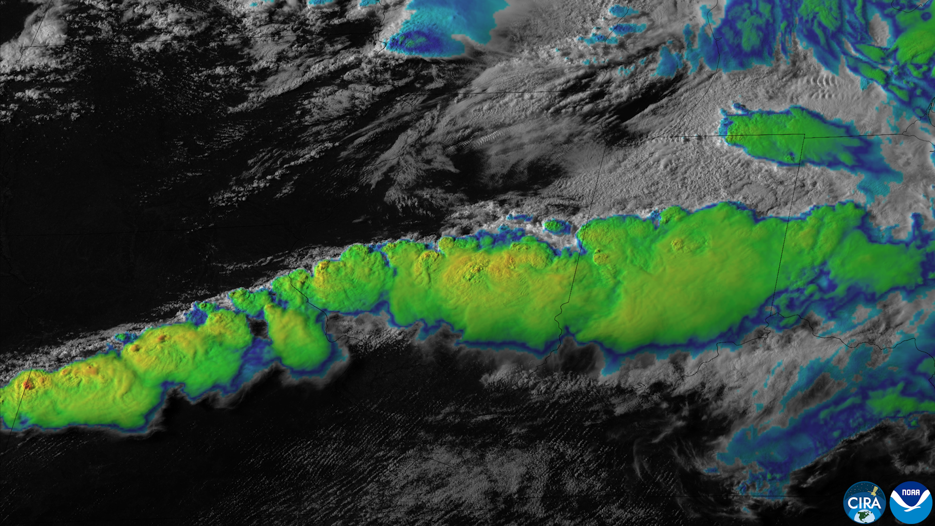
Multiple national weather outlets report an active severe-weather setup moving into the Plains and the Upper Midwest for Friday, with storm coverage extending at times into parts of the Midwest and eastern U.S. The Weather Channel, AccuWeather, FOX Weather, WeatherNation and other outlets describe a dynamic system capable of producing large hail, damaging straight-line winds, flash flooding and isolated tornadoes.
Forecasters describe the pattern as a classic late‑summer-to‑early‑fall transition: a frontal boundary and strong low‑level flow will help organize thunderstorms that could intensify rapidly. Coverage and timing will vary by locality, but the consistent picture across independent reports is heightened severe‑weather potential across the Upper Midwest on Friday.
Because storms of this type can produce sudden, localized impacts — downed trees, snapped power lines, travel disruptions and flash flooding — the setup has immediate public‑safety relevance for communities in the threatened corridor. Multiple outlets emphasize that conditions could change quickly and that local National Weather Service (NWS) offices and the Storm Prediction Center (SPC) should be checked for watches, warnings and official guidance.
Timing and areas of highest risk
Reporting reviewed by Freedom News places the primary window of severe storms on Friday. Outlets use regional labels rather than identical state lists; they consistently identify the Upper Midwest as the primary focus, with additional threat along portions of the Plains and into some Midwestern and eastern areas at different times.
Because the published coverage from national outlets varies in geographic wording, Freedom News is not presenting a single county‑by‑county map here. Instead, residents in the Upper Midwest should consider themselves in the core risk area and watch for local NWS products. Several reporters note that the highest threat is likely where instability and low‑level shear overlap along the frontal zone — a detail local NWS offices will translate into watches and warnings if necessary.
Timing will be driven by the forward motion of the frontal system and the diurnal heating cycle; most outlets indicate storms will become most numerous and intense during the daytime into the evening hours on Friday. That means afternoon and evening travel could be affected in the worst‑hit corridors.
Expected hazards and impacts
Across the coverage, four clear hazards are repeatedly mentioned: large hail, damaging straight‑line winds, flash flooding and a brief tornado risk. AccuWeather and FOX Weather highlight the combination of hail and damaging winds; WeatherNation and The Weather Channel foreground the tornado threat as isolated but plausible where storms become most organized.
None of the supplied summaries provide precise probabilistic numbers (for example, exact hail diameters, wind gust ranges, or SPC categorical probabilities), so Freedom News is not publishing numerical thresholds here. The qualitative consensus is that hail could reach damaging sizes in some stronger storms, wind gusts could be strong enough to cause structural damage or down trees, and heavy rain in training or slow‑moving storms could produce flash flooding.
Practical impacts tied to those hazards include localized power outages from fallen trees or snapped lines, hazardous driving conditions from both wind‑blown debris and flooded roadways, and potential structural or vehicle damage from large hail. Because flash flooding can be fast and localized, even normally passable low‑water crossings can become dangerous in heavy downpours.
What readers should do now
Check local National Weather Service office products and the Storm Prediction Center for the latest watches and warnings. The situation can evolve quickly; local NWS offices issue the official watches and warnings that describe timing, threat areas and recommended protective actions.
Prepare a plan to shelter quickly during severe thunderstorms: identify the safest interior room or basement, secure or move vehicles under cover if hail is expected, and avoid travel during active warnings. If flooding begins, never drive through flooded roadways; turn around, don’t drown.
Because the supplied reporting does not include direct copies of SPC outlooks or NWS statements, Freedom News recommends readers rely on local NWS web pages, NWS social channels, or official weather radio for authoritative, real‑time instructions. Emergency managers and utility companies typically post updates when outages or road closures occur.
What to watch next
Look for SPC convective outlook updates and any mesoscale discussions or tornado/hazardous weather outlooks they post. Local NWS offices will issue watches (broader) and warnings (localized, immediate) as necessary — those products are the definitive signal to take protective action.
National outlets are already flagging the situation; over the next 12–24 hours, expect tighter geographic detail and possibly watch boxes as forecasters refine where instability and shear overlap. If you are in the Upper Midwest or along the system’s projected path, have a plan to receive warnings (phone alerts, weather radio, local media) and prepare for rapid changes in conditions on Friday.
Freedom News will update this item as official SPC outlooks, mesoscale discussions, and NWS watches or warnings are published and as local impacts (power outages, road closures) are reported by authorities.
Sources reviewed
- The Weather Channel: Severe storms bring hail, tornado threat to Midwest Friday
- Breaking News, Latest News and Videos: Nearly 80 million people on alert as severe storms expected to hit the East Coast - ABC News
- AccuWeather: Severe thunderstorms, flash flooding threaten Plains, Midwest, East
- FOX Weather: Taste of fall sweeps across the Midwest as severe storms, damaging winds and flooding threaten millions
- WeatherNation: Active Stretch Ahead for the Upper Midwest
- Yahoo: Severe storms take aim at Upper Midwest on Friday
- cedarnews.net: Severe Storm Threat Intensifies Across Upper Midwest With Large Hail, Damaging Winds and Tornado Risk
- JournalArta: Severe storms, hail and brief tornado risk as Friday heat gives way across parts of U.S. Midwest and East
- Rolling Out: U.S. Braces for Fierce Friday Tornado Threat in Seven States